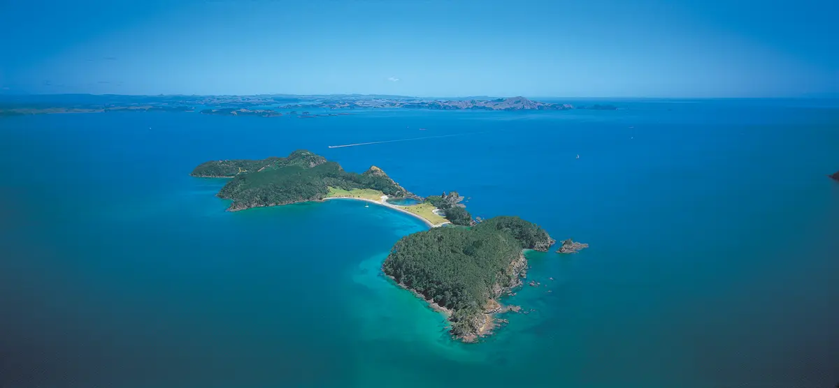
Moturua Island is a 136-hectare pest-free scenic reserve in the heart of the eastern Bay of Islands where native birds thrive and conservation vision has become reality. Since Project Island Song successfully eradicated rats, stoats, and mice, the island has transformed from silent farmland into a living sanctuary where North Island robins, saddlebacks, red-crowned parakeets, and other rare species flourish.
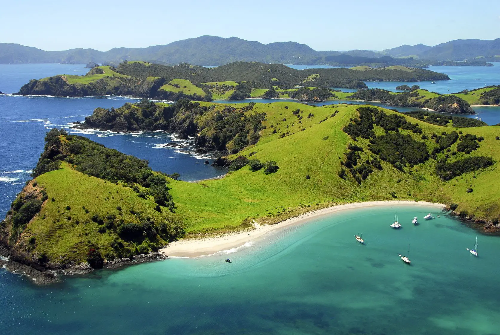
The island offers four distinct beaches – Otupoho (Homestead Bay), Waipao (Frenchman’s Bay), Waiwhapuku (Army Bay), and Mangahawea – each with excellent swimming and snorkelling. The 4.6-kilometre Moturua Island Track loops the entire island, providing 360-degree views of the Bay of Islands while passing 27 archaeological sites spanning prehistoric Māori settlement through World War II occupation.
Whether visiting for a few hours to walk the loop track and swim, or spending a full day exploring beaches and birdwatching, Moturua delivers an accessible island experience that demonstrates what the Bay of Islands looked and sounded like before human-introduced pests arrived.
Why Moturua Island Matters
Moturua’s traceable history extends from the earliest Polynesian settlement to modern conservation breakthroughs, making it one of the Bay of Islands’ most historically significant islands.
Archaeological evidence demonstrates continuous Māori occupation from prehistoric times, with 27 significant sites including fortified pā, middens, gardening terraces, and food storage pits. A moa bone discovered within ancient food refuse provides tangible connection to New Zealand’s earliest human era.
In November 1769, Captain James Cook anchored offshore and traded with local Māori. Three years later, French explorer Marion du Fresne established a camp on the island with hospital, forge, and quarters. This peaceful occupation ended in bloodshed when du Fresne and crew members were attacked while fishing, followed by French retaliation that resulted in approximately 250 Māori deaths – one of the bloodiest early encounters between Europeans and Māori in New Zealand.
During World War II, the New Zealand Navy established observation posts and military infrastructure. A mine observation post remains at Hikurangi pā, along with concrete pads and underground remains visible today.
Modern conservation began with Project Island Song’s restoration program starting in 2009. After the island was declared pest-free, systematic reintroduction of rare native birds began. North Island robins, initially translocated in 1986 but unsuccessful due to rats, were successfully reintroduced in 2014 and now breed successfully. Saddlebacks, whiteheads, red-crowned parakeets, and North Island brown kiwi followed. The island now serves as a critical sanctuary demonstrating the “halo effect” – as bird populations establish on pest-free islands, they increasingly venture to the wider region where good pest control exists.
What to See & Do on Moturua Island
Exploring Moturua: The Island Track & Wildlife
The Walk
The 4.6-kilometre loop track around Moturua is classified as an easy 2.5-hour walk by DOC, though most visitors take 3-4 hours when stopping to explore archaeological sites, enjoy views, and birdwatch. The track can be accessed from any of the island’s four main beaches, allowing flexible itineraries.
The walk delivers constant rewards: magnificent 360-degree views across the eastern Bay of Islands from elevated sections, 27 archaeological sites with interpretation explaining their significance, and varied habitats including coastal pōhutukawa forest, regenerating native bush dominated by hangehange and coprosma, and open areas where native plantings are establishing.
Wildlife Along the Track
Moturua’s pest-free status since 2014 has enabled spectacular wildlife recovery, making every walk an immersive encounter with rare native birds that have vanished from most mainland forests. The island is now home to North Island robins, saddlebacks, whiteheads, red-crowned parakeets, and North Island brown kiwi. As the sanctuary becomes established, species are also returning naturally including tūī (now three times more numerous than pre-restoration), kererū (wood pigeon), fantail, and silvereye.
The best wildlife viewing is early morning or late afternoon when birds are most active. Walk quietly and stop frequently – the island’s birds reward patient visitors, with curious robins often appearing within minutes of standing still.
Track Conditions & Rules
The track is well-maintained with good signage, suitable for most fitness levels. Dogs are not permitted to protect native wildlife. The loop can be walked in either direction from any beach – most visitors starting at Otupoho Bay walk clockwise, but counterclockwise works equally well.
Allow time to stop, be quiet, and observe – the island’s birds reward patient visitors. Bring sturdy walking shoes, plenty of water (at least 1-2 litres per person), sun protection, and insect repellent. Stay on marked tracks to prevent weed seed spread and protect archaeological sites.
Four Distinct Beaches
Each of Moturua’s four main beaches offers different character and excellent water access:
Otupoho (Homestead Bay): The most developed beach with the island’s only facilities – compostable toilets and picnic areas. This sheltered bay on the western side provides calm swimming conditions and serves as the main landing point for most visitors. Good snorkelling around the bay edges.
Waipao (Frenchman’s Bay): Named for Marion du Fresne’s 1772 French camp, this beach offers historical connection alongside natural beauty. More secluded than Otupoho with excellent swimming conditions.
Waiwhapuku (Army Bay): Named for the WWII military occupation, this bay on the island’s back (eastern) side is more exposed but offers dramatic scenery and good swimming on calm days. The concrete pads from WWII barracks remain visible.
Mangahawea: The fourth beach offers the most remote feel, often having visitors to themselves even during busy periods.
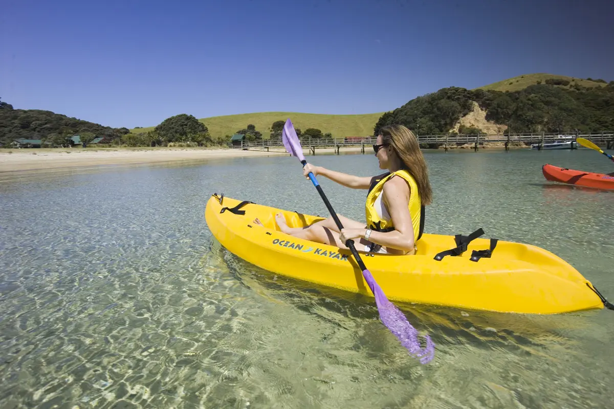
All beaches provide crystal-clear water ideal for swimming and snorkelling. The variety means you can always find shelter from whatever wind direction prevails. Mooring is permitted at any beach for private vessels.
Archaeological Sites
The 27 archaeological sites visible along the island track span 1,000+ years of human occupation. Interpretation panels explain features including:
Prehistoric Māori sites: Fortified pā with visible defensive ditches and terraces, village sites with garden terraces and kumara storage pits, midden sites containing food refuse (including moa bones), and working areas for tool-making and food preparation.
Colonial era sites: The approximate location of du Fresne’s 1772 French camp at Waipao Bay, and evidence of 19th-century farming including stone walls and cleared land patterns.
WWII military sites: Mine observation post at Hikurangi pā (still standing), concrete pads from barracks and ablution blocks at Army Bay, and underground remains of radio and ancillary rooms.
The archaeological richness makes Moturua an outdoor museum where New Zealand’s complex history remains visible in the landscape. All sites are legally protected under the Historic Places Act – observe from tracks without disturbing features.
Practical Info: Getting There & Visitor Tips
Getting There
Moturua Island is accessible only by water. Most visitors arrive via yacht charter, private boats, or water taxi.
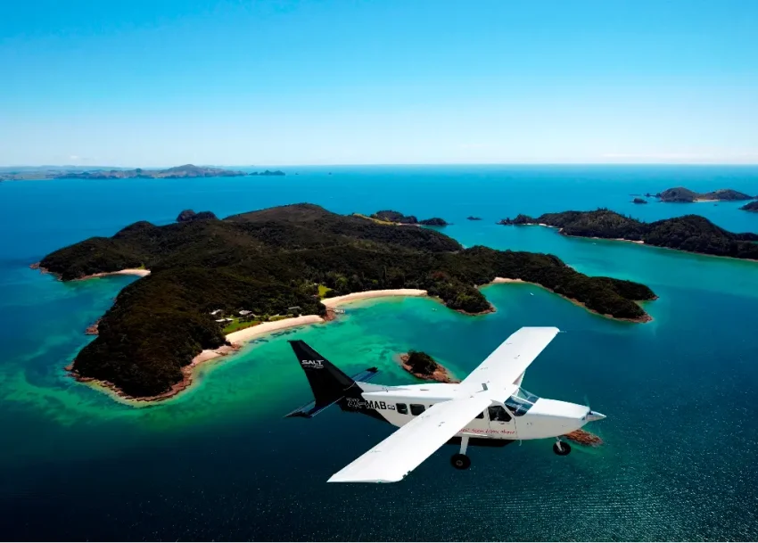
By Yacht Charter: Companies like Great Escape offer bareboat charters where experienced sailors can rent yachts to explore the Bay of Islands, including Moturua Island’s sheltered bays. The island is approximately 10 minutes by boat from Otehei Bay (Urupukapuka Island).
By Private Boat or Kayak: Moturua is approximately 15-20 minutes by boat from Russell or Rawhiti. All four beaches offer safe mooring in appropriate conditions – choose your landing beach based on wind direction and sea conditions. Experienced kayakers can reach the island from Russell or nearby anchorages, though the crossing requires appropriate skills and safety equipment. Remember you’re traveling through the Bay of Islands Marine Mammal Sanctuary – follow all vessel restrictions. The channel between Moturua and neighbouring Motuarohia is a marine mammal safe zone with specific rules.
Facilities & Services
What’s available: Compostable toilet facilities at Otupoho (Homestead Bay), picnic areas, and interpretation panels along the track explaining archaeological and natural features.
What’s NOT available: No café, shop, drinking water, shelter, or any commercial facilities. No mobile phone coverage. No camping permitted on Moturua.
What to bring: Water (essential – at least 1-2 litres per person for the loop walk), sun protection, lunch/snacks, swimming gear, snorkelling equipment if desired, sturdy walking shoes, camera, and insect repellent. Bring all supplies needed as nothing is available for purchase.
Critical Biosecurity Information
Moturua’s pest-free status requires constant vigilance:
Before visiting:
- Clean all footwear thoroughly – scrub off all soil and seeds
- Check all bags, gear, and equipment for rodents, insects (especially Argentine ants), and seeds
- Follow “Check, Clean, Seal” protocols
- Stay on marked tracks to prevent weed seed spread
- No pets (except registered assistance dogs)
On the island:
- Stay on designated tracks
- Take all rubbish with you (pack in, pack out)
- Report any pest sightings immediately to Project Island Song
Even a single introduced pest could undo years of restoration work. Every visitor plays a critical role in maintaining the island’s pest-free status.
Visitor Tips
Time required: The 4.6km loop track takes 2.5-4 hours depending on pace and stops. Add swimming and beach time for a half-day visit, or spend a full day exploring all beaches and maximizing wildlife viewing.
Best time to visit: Early morning offers coolest walking conditions and most active birdlife. Summer provides warmest swimming conditions but can be busy. Shoulder seasons (March-May, September-November) offer excellent weather with fewer visitors.
Wildlife watching: Walk quietly, stop frequently, and scan the forest floor and lower branches – robins often appear within minutes of stopping. Listen for saddleback chatter in the canopy. Early morning and late afternoon provide best viewing opportunities.
Track direction: The loop can be walked in either direction. Most visitors starting at Otupoho Bay walk clockwise, but counterclockwise works equally well.
Swimming safety: While beaches are generally safe, assess conditions on arrival. Choose your beach based on wind direction – the island’s multiple bays mean you can usually find shelter. Supervise children closely.
Photography: The 360-degree viewpoints along the track provide spectacular Bay of Islands panoramas. Bring binoculars for distant views and bird identification.
Archaeological sites: All sites are legally protected. Look but don’t touch, and stay on marked tracks near sensitive areas.
Weather: The island offers limited natural shelter. Bring sun protection on fine days and rain gear if weather is unsettled.
Respect the sanctuary: Moturua’s wildlife recovery depends on every visitor following biosecurity protocols and treating the island with care. Your diligence helps protect this special place.
Local Listings to Explore
Tours & Activities
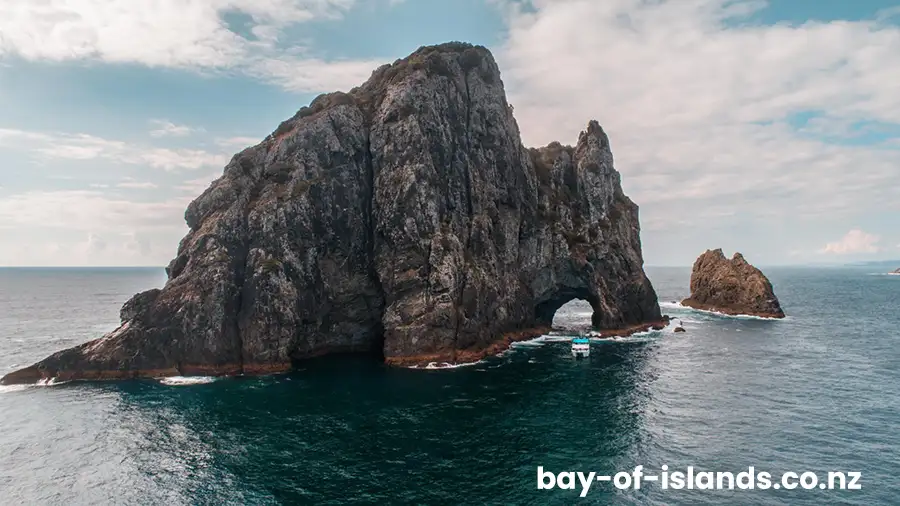
Bay of Islands Cruises Various sightseeing cruises may include stops at Moturua Island. Check with cruise operators for current itineraries. Many cruises combine multiple islands with attractions like the Hole in the Rock at Cape Brett.
Browse more Tours & Activities in the Bay of Islands
Accommodation Near Moturua Island
No accommodation exists on Moturua Island itself. Visitors base themselves in Paihia, Russell, or other Bay of Islands towns, all offering numerous accommodation options within easy boat access to the island.
Browse Accommodation options in the Bay of Islands
Food & Drink
No food or beverage facilities exist on Moturua Island. Bring all food and drinks needed for your visit. For dining before or after your island trip, Paihia and Russell offer numerous restaurants, cafés, and takeaway options.
Map
Sorry, no records were found. Please adjust your search criteria and try again.
Sorry, unable to load the Maps API.